Land Conservation Strategies.
Land
Covers
Land cover is the physical material at the surface
of the earth. There are two primary methods for capturing information on land
covers, they are
ü Field
survey
ü Analysis
of remotely sensed imagery
Classification
of land covers
According to the classification system that used in
NLCD 92 following are the classes of land covers.
·
Water
·
Shrub land
·
Barren
·
Developed
·
Forest upland
·
Non- natural woody
·
Semi-natural vegetation
Water
-All areas of open water or permanent ice/snow
cover.
Developed
-Areas characterized by a high percentage (30% or
greater) of constructed materials.
Ex: asphalt, concrete
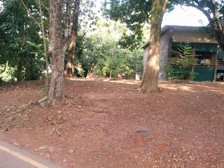
Barren
-Areas characterized by bare rock, gravel, sand,
silt, clay or other earthen material, with little or no green vegetation percentage
regardless of its inherent ability to support life.
Forest
upland
-Areas characterized by tree cover (natural or
semi-natural woody vegetation, generally greater than 6m tall)
Shrubland
-Areas characterized by natural or semi natural woody
vegetation with aerial stems, generally less than 6m tall, with individuals or
clumps not touching to interlocking.
Non-natural
woody
-Areas dominated by non- natural woody vegetation.
Importance
of land covering
Land coverings are important to protect the natural
and agricultural lands. The protection of natural and agricultural lands is
linked to sustainable economy and healthy communities. Also, they are important
to protect the water bodies, clean air recreation etc. In addition, developed
land covers provide just as important to our economy and wellbeing as our
roads, residential and others.
Examples
for land covers in our university.
ü Water
ü
Developed
Barren
SShrub-land.
Non-naturally
woody
Group
number 31
Group
members:
·
Kurukulasooriya
I.N -162643U
·
Manohara
P.W.V -162694B
·
Piyaveera
R.H.L.R -162662C
·
Premathilaka
.U.G.K.A -162732R
·
Wijewantha
N.W.P.P -162687G


No comments:
Post a Comment